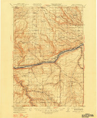
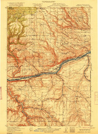
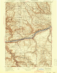
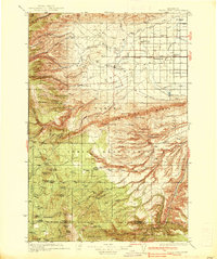
1916 Map of Arlington
USGS Topo · Published 1948About this map
The Columbia River serves as the dominant geographic and economic spine of this region, separating the high plateaus of Klickitat County, Washington, from Gilliam County, Oregon. In the early twentieth century, this corridor was a vital transportation hub where the Spokane Portland and Seattle Ry and the Oregon-Washington Railroad & Navigation Co paralleled the water. Settlement is concentrated along these rails at points like Arlington, Blalock, and Roosevelt. To the south, the Oregon Trail cuts across the arid landscape near Shutler and Turner Butte, tracing the paths of earlier migrations. The map reveals a rural society structured around local education, with numerous isolated schoolhouses such as Oak Grove School and Big Horn School serving ranching outposts like Stegeman Ranch and Sixprong Ranch situated among the high ridges of Alder Ridge.
Find a feature on this map
78 named features on this map. Tap any name to fly to it.
Don’t see what you’re looking for? This feature index may not catch every label — zoom into the map to look around manually.
Map Details
Editions of this 1916 Arlington Map
4 editions found
Other maps of this area

1906 · Blalock Island
USGS Topo · 1:125,000

1908 · Blalock Island
USGS Topo · 1:125,000

1910 · Zillah
USGS Topo · 1:125,000

1915 · Prosser
USGS Topo · 1:125,000

1916 · Arlington
USGS Topo · 1:125,000

1916 · Condon
USGS Topo · 1:125,000

1917 · Prosser
USGS Topo · 1:125,000
1937 · White Swan
USGS Topo · 1:125,000

1950 · Yakima
USGS Topo · 1:250,000

1953 · Pendleton
USGS Topo · 1:250,000