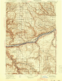
1916 Map of Arlington
USGS Topo · Published 1941About this map
The Columbia River serves as a powerful boundary between Oregon and Washington on this 1912-1913 survey, which captures the river before modern dams altered its course. Along its banks, dangerous navigation points like the Owyhee Rapids and Blalock Rapids define the water's character, while the parallel lines of the Spokane Portland And Seattle RY and the Union Pacific railroad reflect the vital transportation corridor of the era. South of the river in Oregon, the historic path of the Oregon Trail remains a visible landmark across the landscape.
Find a feature on this map
62 named features on this map. Tap any name to fly to it.
Don’t see what you’re looking for? This feature index may not catch every label — zoom into the map to look around manually.
Map Details
Editions of this 1916 Arlington Map
4 editions found
Other maps of this area

1906 · Blalock Island
USGS Topo · 1:125,000

1908 · Blalock Island
USGS Topo · 1:125,000

1910 · Zillah
USGS Topo · 1:125,000

1915 · Prosser
USGS Topo · 1:125,000

1916 · Arlington
USGS Topo · 1:125,000

1916 · Condon
USGS Topo · 1:125,000

1917 · Prosser
USGS Topo · 1:125,000

1937 · White Swan
USGS Topo · 1:125,000

1950 · Yakima
USGS Topo · 1:250,000

1953 · Pendleton
USGS Topo · 1:250,000