Loading...
Loading map...2024 Map of Armorel
USGS Topo · Published 2024About this map
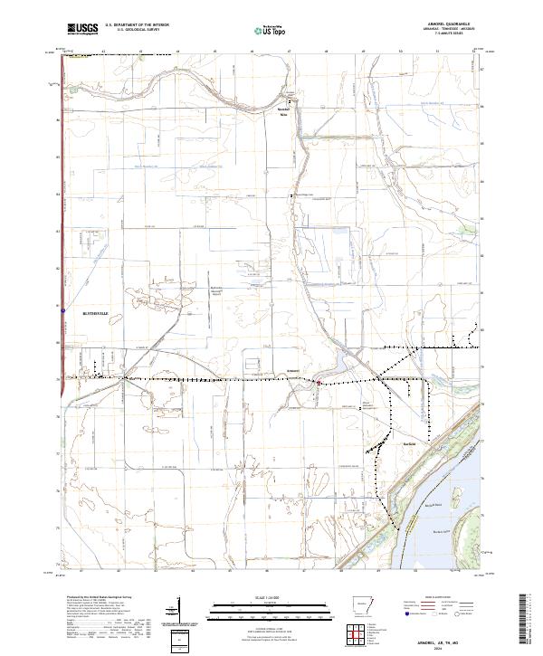
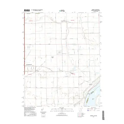
Armorel sits at the heart of an intricate network of drainage canals and agricultural lands in the Mississippi River delta. This landscape is defined by its water management, where a systematic grid of channels including Ditch Number 51 and Ditch Number 42 crisscross the alluvial plain to support local farming. The Mississippi River itself forms the eastern boundary, marked by sharp turns at Barfield Bend and Ruckers Point.
Find a feature on this map
88 named features on this map. Tap any name to fly to it.
Don’t see what you’re looking for? This feature index may not catch every label — zoom into the map to look around manually.
Map Details
Date Portrayed2024
Date Published2024
PublisherU.S. Geological Survey
Map TypeTopographic
Scale1:24,000
Physical Dimensions24 x 29 inches
Editions of this 2024 Armorel Map
This is the sole edition of this map. No revisions or reprints were ever made.
Historical Maps of Blytheville Through Time
6 maps found
Featured Locations
Source Details
SourceU.S. Geological Survey
CopyrightPublic Domain