
1892 Map of Arredondo
USGS Topo · Published 1892About this map
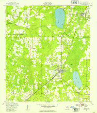
Gainesville serves as the focal point of this North Florida landscape, depicted during a period of significant railway expansion. The city is a bustling junction for the Peninsula Rail Road, the Central Florida and Peninsular Rail Road, and the Savannah Florida and Western Rail Road. This transportation network connects smaller outlying settlements like Arredondo, Kanapaha, and Fairbanks.
Find a feature on this map
66 named features on this map. Tap any name to fly to it.
Don’t see what you’re looking for? This feature index may not catch every label — zoom into the map to look around manually.
Map Details
Editions of this 1892 Arredondo Map
This is the sole edition of this map. No revisions or reprints were ever made.
Other maps of this area

1890 · Arredondo
USGS Topo · 1:62,500

1893 · Citra
USGS Topo · 1:62,500

1894 · Arredondo
USGS Topo · 1:62,500

1895 · Williston
USGS Topo · 1:62,500

1895 · Citra
USGS Topo · 1:62,500

1938 · Hawthorn
USGS Topo · 1:48,000

1941 · Starke
USGS Topo · 1:62,500

1943 · Hawthorn
USGS Topo · 1:62,500

1948 · Starke
USGS Topo · 1:50,000
1949 · Waldo
USGS Topo · 1:24,000