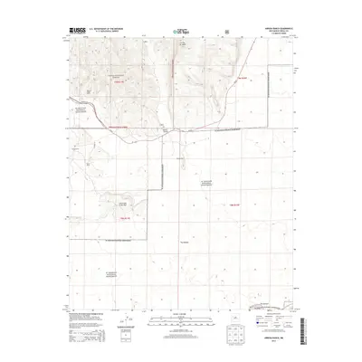
2013 Map of Arrosa Ranch
USGS Topo · Published 2013About this map
El Malpais National Monument dominates this high-desert landscape in Cibola County, where volcanic terrain meets traditional ranching lands. The map details a complex geological environment, including the extensive lava flows of The Malpais and the prominent southern corridor known as The Narrows along NM-117. Isolated family holdings like Arrosa Ranch, Porter Ranch, and Reid and Bright Ranch are scattered across the quadrangle, illustrating the enduring agricultural footprint within the protected boundaries of the Cibola National Forest. Geographic landmarks such as Little Hole in the Wall and the volcanic peaks of Cerritos de Jaspe provide essential orientation for researchers of Western land use. The transport network is defined by State Rte 53 and Co Road 44, which navigate the mesas and canyons like Bonita Canyon.
Find a feature on this map
19 named features on this map. Tap any name to fly to it.
Don’t see what you’re looking for? This feature index may not catch every label — zoom into the map to look around manually.
Map Details
Editions of this 2013 Arrosa Ranch Map
This is the sole edition of this map. No revisions or reprints were ever made.
Other maps of this area

1883 · Mt. Taylor
USGS Topo · 1:250,000

1886 · Wingate
USGS Topo · 1:250,000

1886 · Mt. Taylor
USGS Topo · 1:250,000

1892 · Wingate
USGS Topo · 1:250,000

1892 · Mt. Taylor
USGS Topo · 1:250,000

1899 · Mt. Taylor
USGS Topo · 1:250,000

1917 · Broom Mountain
USGS Topo · 1:125,000

1952 · Paxton Springs
USGS Topo · 1:24,000

1954 · Saint Johns
USGS Topo · 1:250,000

1954 · Socorro
USGS Topo · 1:250,000