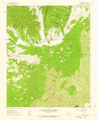
1961 Map of Arrosa Ranch
USGS Topo · Published 1963About this map
The high desert volcanic landscape dominates this early 1960s study of Valencia County. Defined by extensive fields of Lava, the area is anchored by The Malpais, where the terrain transitions from the timbered heights of the Cibola National Forest to striking geological formations. The map documents the localized ranching economy of the era, noting established sites like Arrosa Ranch, Porter Ranch, and the Red and Bright Ranch. To the west, the winding Bonita Canyon provides a natural corridor through the highlands, while distinctive landmarks like Cerritos de Jasper and the evocative Little Hole in the Wall emphasize the intricate relief of the plateau. Transportation is limited to State Routes 53 and 117, which skirt the edges of the lava flows near The Narrows. Small industrial markers, including a Gravel Pit and scattered Prospects, suggest the search for mineral resources within this complex geology.
Find a feature on this map
15 named features on this map. Tap any name to fly to it.
Don’t see what you’re looking for? This feature index may not catch every label — zoom into the map to look around manually.
Map Details
Editions of this 1961 Arrosa Ranch Map
This is the sole edition of this map. No revisions or reprints were ever made.
Other maps of this area

1883 · Mt. Taylor
USGS Topo · 1:250,000

1886 · Wingate
USGS Topo · 1:250,000

1886 · Mt. Taylor
USGS Topo · 1:250,000

1892 · Wingate
USGS Topo · 1:250,000

1892 · Mt. Taylor
USGS Topo · 1:250,000

1899 · Mt. Taylor
USGS Topo · 1:250,000

1917 · Broom Mountain
USGS Topo · 1:125,000

1952 · Paxton Springs
USGS Topo · 1:24,000

1954 · Saint Johns
USGS Topo · 1:250,000

1954 · Socorro
USGS Topo · 1:250,000