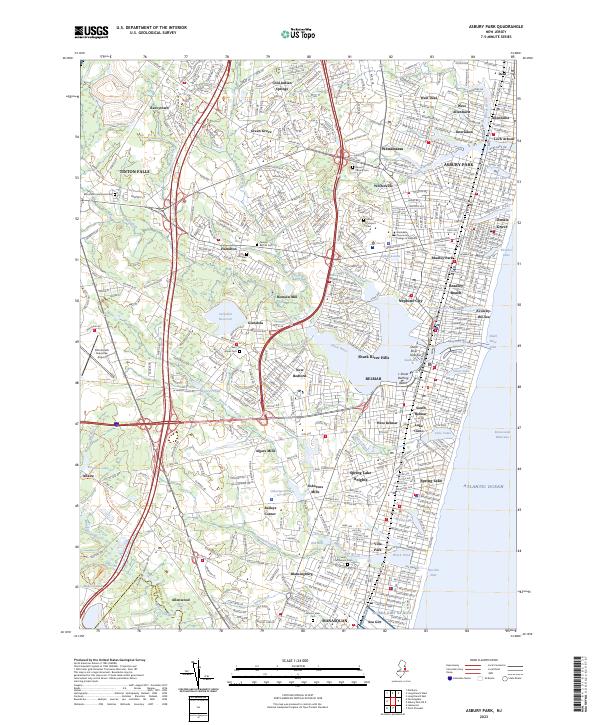
2023 Map of Asbury Park
USGS Topo · Published 2023About this map
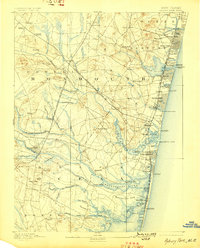
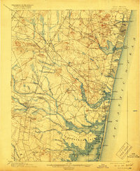
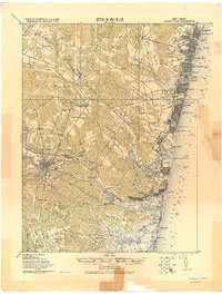
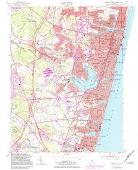
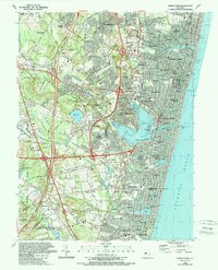
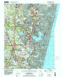
The Shark River and its intricate tributaries dominate the landscape of coastal Monmouth County, feeding into the Shark River Inlet and the Atlantic Ocean. This modern survey reveals a dense network of seaside communities stretching from Asbury Park and Ocean Grove southward to Manasquan and Sea Girt. Inland, the terrain is defined by the Glendola Reservoir and the expansive grounds of Allaire park, while the Garden State Parkway and Monmouth Executive Airport underscore the area's role as a major transportation hub. Local history and genealogy are preserved in numerous sites such as Mount Calvary Cem, Temple Beth El Cem, and the historic clusters at Osbornes Mills and Baileys Corner. The shoreline remains a primary focus, featuring the L Street Bathing Beach and several named lakes including Sunset Lake, Wesley Lake, and Silver Lake that separate the coastal boroughs.
Find a feature on this map
87 named features on this map. Tap any name to fly to it.
Don’t see what you’re looking for? This feature index may not catch every label — zoom into the map to look around manually.
Map Details
Editions of this 2023 Asbury Park Map
This is the sole edition of this map. No revisions or reprints were ever made.
Historical Maps of Neptune City Through Time
8 maps found