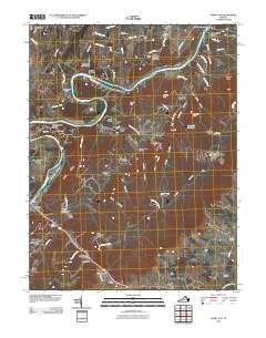
2010 Map of Ashby Gap
USGS Topo · Published 2010About this map
The Shenandoah River carves through the landscape here, defining a region of ferry crossings and mountain passes along the eastern edge of Clarke County. At the southern end of the sheet, the village of Paris sits at the foot of Ashby Gap, where travelers have long crossed the Blue Ridge mountains. This corridor is marked by historically significant transit points like Castlemans Ferry and the Paris Post Office. The terrain is characterized by a series of prominent ridges and hollows, including Slate Ridge, Bolden Hollow, and Ashby Hollow, which have shaped local settlement patterns for generations.
Find a feature on this map
89 named features on this map. Tap any name to fly to it.
Don’t see what you’re looking for? This feature index may not catch every label — zoom into the map to look around manually.
Map Details
Editions of this 2010 Ashby Gap Map
This is the sole edition of this map. No revisions or reprints were ever made.
Other maps of this area

1884 · Harpers Ferry
USGS Topo · 1:125,000

1891 · Harpers Ferry
USGS Topo · 1:125,000

1893 · Luray
USGS Topo · 1:125,000

1893 · Harpers Ferry
USGS Topo · 1:125,000

1894 · Warrenton
USGS Topo · 1:125,000

1894 · Winchester
USGS Topo · 1:125,000

1905 · Luray
USGS Topo · 1:125,000

1916 · Berryville
USGS Topo · 1:62,500

1938 · Winchester
USGS Topo · 1:48,000

1939 · Front Royal
USGS Topo · 1:48,000