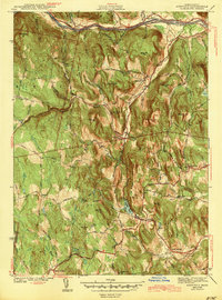
1943 Map of Ashfield
USGS Topo · Published 1943About this map
The hills of western Massachusetts are carved by the Deerfield River and its numerous tributaries in this early 1940s landscape. Central to the map is Ashfield, a high-elevation village near the headwaters of the South River and the shores of Ashfield Pond. The terrain is characterized by family-named landmarks like Mary Lyon Hill and Orcutt Hill, reflecting a long history of upland farming and settlement. Along the northern edge, the Boston And Maine Railroad follows the river valley parallel to the famed Mohawk Trail, which served as a primary transportation artery through the Berkshires. Smaller clusters like Spruce Corner and Baptist Corner mark the intersections of rural roads, while isolated family burial grounds such as Leavitt Cem and Doane Cem provide valuable data for genealogists tracing the inhabitants of these Franklin County hill towns before modern development.
Find a feature on this map
55 named features on this map. Tap any name to fly to it.
Don’t see what you’re looking for? This feature index may not catch every label — zoom into the map to look around manually.
Map Details
Editions of this 1943 Ashfield Map
2 editions found
Other maps of this area

1885 · Northampton
USGS Topo · 1:62,500

1886 · Hawley
USGS Topo · 1:62,500

1886 · Chesterfield
USGS Topo · 1:62,500

1886 · Northampton
USGS Topo · 1:62,500

1888 · Chesterfield
USGS Topo · 1:62,500

1890 · Hawley
USGS Topo · 1:62,500

1890 · Greenfield
USGS Topo · 1:62,500

1891 · Northampton
USGS Topo · 1:62,500

1893 · Northampton
USGS Topo · 1:62,500

1893 · Chesterfield
USGS Topo · 1:62,500