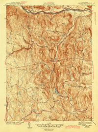
1943 Map of Ashfield
USGS Topo · Published 1943About this map
The Deerfield River corridor and the historic Mohawk Trail anchor the northern landscape of this 1940 survey, showing the interconnected hill towns of Franklin County during the early years of World War II. The Boston and Maine Railroad follows the river's path, serving as a vital industrial artery through East Charlemont. Moving south into the interior, the map reveals a decentralized settlement pattern defined by crossroads hamlets like Baptist Corner, Buckland Four Corners, and Spruce Corner.
Find a feature on this map
58 named features on this map. Tap any name to fly to it.
Don’t see what you’re looking for? This feature index may not catch every label — zoom into the map to look around manually.
Map Details
Editions of this 1943 Ashfield Map
2 editions found
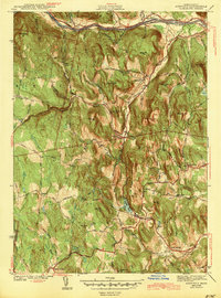
Other maps of this area

1885 · Northampton
USGS Topo · 1:62,500

1886 · Hawley
USGS Topo · 1:62,500

1886 · Chesterfield
USGS Topo · 1:62,500

1886 · Northampton
USGS Topo · 1:62,500

1888 · Chesterfield
USGS Topo · 1:62,500

1890 · Hawley
USGS Topo · 1:62,500

1890 · Greenfield
USGS Topo · 1:62,500

1891 · Northampton
USGS Topo · 1:62,500

1893 · Northampton
USGS Topo · 1:62,500

1893 · Chesterfield
USGS Topo · 1:62,500