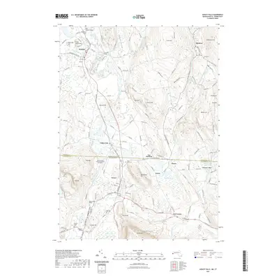
2021 Map of Ashley Falls
USGS Topo · Published 2021About this map
The Housatonic River and its major tributaries, the Konkapot River and Blackberry River, anchor this landscape at the border of Massachusetts and Connecticut. The river valleys support established settlements such as Ashley Falls and Canaan, while the surrounding uplands are defined by named peaks like Miles Mtn and Rattlesnake Hill. This survey highlights the region's enduring rural character and historical infrastructure, including the Old Covered Bridge crossing Hubbard Brook and the Covered Bridge further south.
Find a feature on this map
153 named features on this map. Tap any name to fly to it.
Don’t see what you’re looking for? This feature index may not catch every label — zoom into the map to look around manually.
Map Details
Editions of this 2021 Ashley Falls Map
This is the sole edition of this map. No revisions or reprints were ever made.
Other maps of this area

1885 · Sheffield
USGS Topo · 1:62,500

1888 · Sheffield
USGS Topo · 1:62,500

1888 · Sandisfield
USGS Topo · 1:62,500

1891 · Sheffield
USGS Topo · 1:62,500

1892 · Winsted
USGS Topo · 1:62,500

1892 · Cornwall
USGS Topo · 1:62,500

1893 · Sheffield
USGS Topo · 1:62,500

1893 · Cornwall
USGS Topo · 1:62,500

1893 · Sandisfield
USGS Topo · 1:62,500

1897 · Sandisfield
USGS Topo · 1:62,500