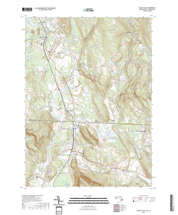
2024 Map of Ashley Falls
USGS Topo · Published 2024About this map
The Housatonic Valley serves as the central corridor for this borderlands survey, where the river winds past the industrial and agricultural heritage of the southern Berkshires and Litchfield Hills. The landscape transitions from the wetlands of Robbins Swamp and Barnum Street Swamp to the distinctive elevations of Rattlesnake Hill and Miles Mtn. Settlement patterns are concentrated around historic crossroads like Ashley Falls and the railroad-oriented center of Canaan, while the surrounding hillsides remain dotted with family cemeteries and small hamlets such as Clayton and Sodom.
Find a feature on this map
150 named features on this map. Tap any name to fly to it.
Don’t see what you’re looking for? This feature index may not catch every label — zoom into the map to look around manually.
Map Details
Editions of this 2024 Ashley Falls Map
This is the sole edition of this map. No revisions or reprints were ever made.
Other maps of this area

1885 · Sheffield
USGS Topo · 1:62,500

1888 · Sheffield
USGS Topo · 1:62,500

1888 · Sandisfield
USGS Topo · 1:62,500

1891 · Sheffield
USGS Topo · 1:62,500

1892 · Winsted
USGS Topo · 1:62,500

1892 · Cornwall
USGS Topo · 1:62,500

1893 · Sheffield
USGS Topo · 1:62,500

1893 · Cornwall
USGS Topo · 1:62,500

1893 · Sandisfield
USGS Topo · 1:62,500

1897 · Sandisfield
USGS Topo · 1:62,500