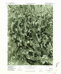
1975 Map of Ashley Falls
USGS Topo · Published 1981About this map
The Housatonic River snakes through the landscape in a complex series of oxbows and meanders, defining the topography of this Massachusetts-Connecticut borderland in the mid-1970s. This orthophotoquad provides an aerial perspective of the region, where the primary settlement of Ashley Falls sits near the confluence with the Konkapot River. The image reveals a mosaic of active farmland and woodlots, punctuated by the concentrated residential footprints of Sheffield and the smaller hamlet of Clayton. To the south, the Blackberry River flows toward Canaan, showing the tight relationship between the river valleys and the primary road and rail corridors. Researchers can observe the land-use patterns of the era, from the open fields of Canaan Valley to the heavily forested slopes surrounding the Mill River in the north.
Find a feature on this map
9 named features on this map. Tap any name to fly to it.
Don’t see what you’re looking for? This feature index may not catch every label — zoom into the map to look around manually.
Map Details
Editions of this 1975 Ashley Falls Map
This is the sole edition of this map. No revisions or reprints were ever made.
Other maps of this area

1885 · Sheffield
USGS Topo · 1:62,500

1888 · Sheffield
USGS Topo · 1:62,500

1888 · Sandisfield
USGS Topo · 1:62,500

1891 · Sheffield
USGS Topo · 1:62,500

1892 · Winsted
USGS Topo · 1:62,500

1892 · Cornwall
USGS Topo · 1:62,500

1893 · Sheffield
USGS Topo · 1:62,500

1893 · Cornwall
USGS Topo · 1:62,500

1893 · Sandisfield
USGS Topo · 1:62,500

1897 · Sandisfield
USGS Topo · 1:62,500