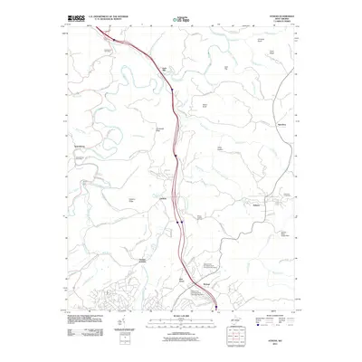
2011 Map of Athens
USGS Topo · Published 2011About this map
The Bluestone River carves a winding path through this corner of Mercer County, anchoring a landscape defined by small communities and high ridges. The eastern portion is dominated by the town of Athens, where the grounds of Concord University sit near the Athens Water Supply Dam. To the west, the river system dictates the local geography, with the Bluestone River joined by numerous tributaries including Brush Creek, Camp Creek, and Laurel Creek. This 2011 survey shows the established transportation corridors that connect these valley settlements, including the path of the interstate cutting north-south between Eads Mill and Gardner. Local history and genealogy interest is concentrated in the scattered post offices at Spanishburg and Camp Creek, while more specialized landmarks like Mercer Healing Springs and Monk Conn Ford point to the historic ways residents interacted with the local terrain and waterways.
Find a feature on this map
83 named features on this map. Tap any name to fly to it.
Don’t see what you’re looking for? This feature index may not catch every label — zoom into the map to look around manually.
Map Details
Editions of this 2011 Athens Map
This is the sole edition of this map. No revisions or reprints were ever made.
Other maps of this area

1887 · Pocahontas
USGS Topo · 1:125,000

1887 · Hinton
USGS Topo · 1:125,000

1890 · Dublin
USGS Topo · 1:125,000

1891 · Pocahontas
USGS Topo · 1:125,000

1891 · Dublin
USGS Topo · 1:125,000

1891 · Raleigh
USGS Topo · 1:125,000

1892 · Hinton
USGS Topo · 1:125,000

1894 · Pocahontas
USGS Topo · 1:125,000

1895 · Pocahontas
USGS Topo · 1:125,000

1897 · Raleigh
USGS Topo · 1:125,000