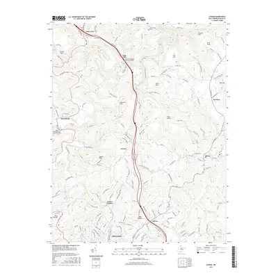
2016 Map of Athens
USGS Topo · Published 2016About this map
Princeton and the academic grounds of Concord Univ anchor this 2016 survey of Mercer County, where the Interstate 77 corridor cuts through the Appalachian landscape. The terrain is defined by a dense network of watercourses like the Bluestone River and Brush Creek, along with named ridges such as Stovall Ridge and Cornbread Ridge. This map provides a modern look at rural West Virginia communities, including Gardner, Spanishburg, and Speedway, while documenting landmarks of local and regional significance.
Find a feature on this map
158 named features on this map. Tap any name to fly to it.
Don’t see what you’re looking for? This feature index may not catch every label — zoom into the map to look around manually.
Map Details
Editions of this 2016 Athens Map
This is the sole edition of this map. No revisions or reprints were ever made.
Other maps of this area

1887 · Pocahontas
USGS Topo · 1:125,000

1887 · Hinton
USGS Topo · 1:125,000

1890 · Dublin
USGS Topo · 1:125,000

1891 · Pocahontas
USGS Topo · 1:125,000

1891 · Dublin
USGS Topo · 1:125,000

1891 · Raleigh
USGS Topo · 1:125,000

1892 · Hinton
USGS Topo · 1:125,000

1894 · Pocahontas
USGS Topo · 1:125,000

1895 · Pocahontas
USGS Topo · 1:125,000

1897 · Raleigh
USGS Topo · 1:125,000