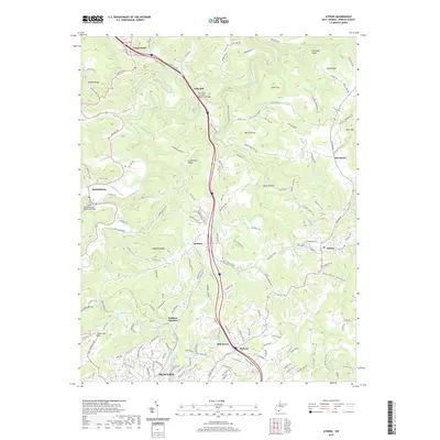
2019 Map of Athens
USGS Topo · Published 2019About this map
Athens and the northern edge of Princeton anchor this Mercer County landscape, where the Bluestone River and Brush Creek wind through a complex system of ridges and hollows. The area's transport history is marked by significant crossings, including the Cornelius Charlton Memorial Bridge and the Hank Williams Senior Memorial Bridge near Spanishburg. This modern survey illustrates the proximity of long-standing small communities like Eads Mill, Gardner, and Speedway to the expanding urban corridor of Princeton. Notable local landmarks such as Mercer Healing Springs and named terrain features like Cornbread Ridge and Black Oak Mtn speak to the region's geographic identity. The map also traces a network of rural routes, from Camp Creek Rd to Stovall Ridge Rd, connecting historically distinct settlements like Melrose and Oak Grove through the high country of Isom Flat and Hector Knob.
Find a feature on this map
160 named features on this map. Tap any name to fly to it.
Don’t see what you’re looking for? This feature index may not catch every label — zoom into the map to look around manually.
Map Details
Editions of this 2019 Athens Map
This is the sole edition of this map. No revisions or reprints were ever made.
Other maps of this area

1887 · Pocahontas
USGS Topo · 1:125,000

1887 · Hinton
USGS Topo · 1:125,000

1890 · Dublin
USGS Topo · 1:125,000

1891 · Pocahontas
USGS Topo · 1:125,000

1891 · Dublin
USGS Topo · 1:125,000

1891 · Raleigh
USGS Topo · 1:125,000

1892 · Hinton
USGS Topo · 1:125,000

1894 · Pocahontas
USGS Topo · 1:125,000

1895 · Pocahontas
USGS Topo · 1:125,000

1897 · Raleigh
USGS Topo · 1:125,000