2023 Map of Athens
USGS Topo · Published 2023About this map
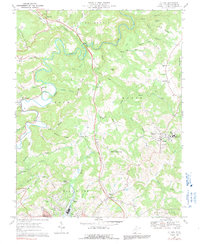
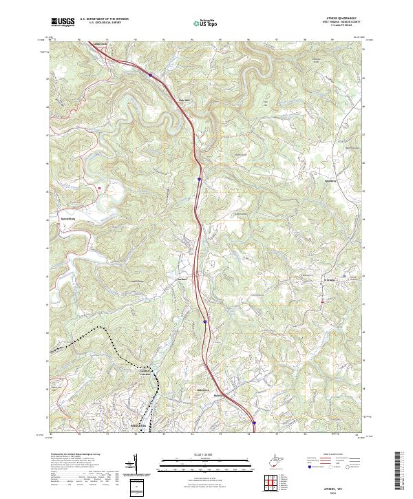
The Bluestone River winds through this Mercer County landscape, serving as a central geographical spine for settlements like Spanishburg and Eads Mill. The area is characterized by a series of prominent ridges and knobs, including Stovall Ridge, Cornbread Ridge, and Hector Knob, which influence the local transportation network. In the eastern portion of the map, the town of Athens serves as a local hub, anchored by the campus of Concord University and several significant burial grounds like the Athens Cemetery - Laurel Creek Rd.
Find a feature on this map
90 named features on this map. Tap any name to fly to it.
Don’t see what you’re looking for? This feature index may not catch every label — zoom into the map to look around manually.
Map Details
Editions of this 2023 Athens Map
This is the sole edition of this map. No revisions or reprints were ever made.