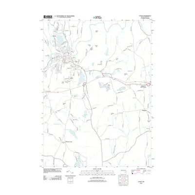
2012 Map of Athol
USGS Topo · Published 2012About this map
The Millers River flows through the heart of this landscape, anchoring a network of small settlements and reservoirs in north-central Massachusetts. Industrial and residential clusters like Pinedale and The Street are densely mapped, showing the complex road systems of Athol alongside established landmarks such as the Po and Highland Cem. The terrain is defined by a series of prominent rises, including High Knob, Conant Hill, and Cobb Hill, which separate the various brook valleys and water catchments.
Find a feature on this map
162 named features on this map. Tap any name to fly to it.
Don’t see what you’re looking for? This feature index may not catch every label — zoom into the map to look around manually.
Map Details
Editions of this 2012 Athol Map
This is the sole edition of this map. No revisions or reprints were ever made.
Other maps of this area

1887 · Warwick
USGS Topo · 1:62,500

1887 · Belchertown
USGS Topo · 1:62,500

1887 · Winchendon
USGS Topo · 1:62,500

1887 · Barre
USGS Topo · 1:62,500

1889 · Barre
USGS Topo · 1:62,500

1889 · Warwick
USGS Topo · 1:62,500

1890 · Belchertown
USGS Topo · 1:62,500

1890 · Winchendon
USGS Topo · 1:62,500

1893 · Belchertown
USGS Topo · 1:62,500

1894 · Winchendon
USGS Topo · 1:62,500