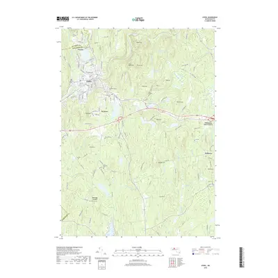
2018 Map of Athol
USGS Topo · Published 2018About this map
Athol and the surrounding Worcester County highlands are defined by a complex network of reservoirs and small mountain peaks in this recent topographic study. The town center sits at the confluence of the Millers River and the Tully River, a geography that historically powered the region's industry. Beyond the urban grid, the landscape transitions into a series of significant elevations including Baldwin Hill, Prospect Hill, and Pratt Hill, which separate numerous water bodies such as Thousand Acre Reservoir and Reservoir Number One.
Find a feature on this map
95 named features on this map. Tap any name to fly to it.
Don’t see what you’re looking for? This feature index may not catch every label — zoom into the map to look around manually.
Map Details
Editions of this 2018 Athol Map
This is the sole edition of this map. No revisions or reprints were ever made.
Other maps of this area

1887 · Warwick
USGS Topo · 1:62,500

1887 · Belchertown
USGS Topo · 1:62,500

1887 · Winchendon
USGS Topo · 1:62,500

1887 · Barre
USGS Topo · 1:62,500

1889 · Barre
USGS Topo · 1:62,500

1889 · Warwick
USGS Topo · 1:62,500

1890 · Belchertown
USGS Topo · 1:62,500

1890 · Winchendon
USGS Topo · 1:62,500

1893 · Belchertown
USGS Topo · 1:62,500

1894 · Winchendon
USGS Topo · 1:62,500