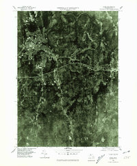
1975 Map of Athol
USGS Topo · Published 1981About this map
Athol serves as the industrial and social anchor of this mid-1970s landscape, situated where the high-density settlement meets the winding path of the Millers River. This orthophotoquad provides an aerial perspective of the transition from the concentrated urban core of the village to the heavily forested and rural stretches of Worcester County. To the southeast, the crossroads of Phillipston and Phillipston Four Corners reveal the traditional New England town structure, where roads converge on small historic centers. Farther south, Burrage Corner marks a distinct point in the more isolated wooded terrain. The 1975 aerial photography emphasizes the region's land use, contrasting the built-up river valley with the expansive tree cover and natural drainage patterns that define the central Massachusetts highlands.
Find a feature on this map
5 named features on this map. Tap any name to fly to it.
Don’t see what you’re looking for? This feature index may not catch every label — zoom into the map to look around manually.
Map Details
Editions of this 1975 Athol Map
This is the sole edition of this map. No revisions or reprints were ever made.
Other maps of this area

1887 · Warwick
USGS Topo · 1:62,500

1887 · Belchertown
USGS Topo · 1:62,500

1887 · Winchendon
USGS Topo · 1:62,500

1887 · Barre
USGS Topo · 1:62,500

1889 · Barre
USGS Topo · 1:62,500

1889 · Warwick
USGS Topo · 1:62,500

1890 · Belchertown
USGS Topo · 1:62,500

1890 · Winchendon
USGS Topo · 1:62,500

1893 · Belchertown
USGS Topo · 1:62,500

1894 · Winchendon
USGS Topo · 1:62,500