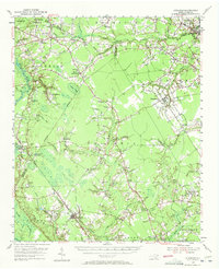
1955 Map of Atkinson
USGS Topo · Published 1972About this map
Penderlea stands as a focal point in this mid-century portrait of southeastern North Carolina, situated near the confluence of Sampson and Duplin counties. The landscape is defined by the winding course of the Black River and numerous tributaries like Moores Creek and Doctors Creek, which shaped the early agricultural and timber economy of the region. The map captures the social fabric of the era through a dense network of country churches and community anchors, including Peters Tabernacle, Wells Chapel, and Antioch Ch.
Find a feature on this map
80 named features on this map. Tap any name to fly to it.
Don’t see what you’re looking for? This feature index may not catch every label — zoom into the map to look around manually.
Map Details
Editions of this 1955 Atkinson Map
2 editions found

Other maps of this area

1942 · Burgaw
USGS Topo · 1:62,500

1943 · Kenansville
USGS Topo · 1:62,500

1947 · Rocky Point
USGS Topo · 1:62,500

1948 · Kenansville
USGS Topo · 1:62,500

1953 · Florence
USGS Topo · 1:250,000

1953 · Beaufort
USGS Topo · 1:250,000

1954 · Florence
USGS Topo · 1:250,000

1954 · Beaufort
USGS Topo · 1:250,000

1954 · White Lake
USGS Topo · 1:62,500

1954 · Acme
USGS Topo · 1:62,500