
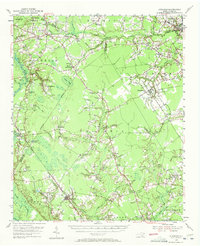
1955 Map of Atkinson
USGS Topo · Published 1957About this map
The Atlantic Coast Line railroad dictates the settlement pattern of this mid-century North Carolina coastal plain landscape, connecting the agricultural hubs of Atkinson and Ivanhoe. The area is defined by its intricate drainage system, where the Black River and Moores Creek wind through heavily forested lowlands. A unique mapping detail includes elliptical bay outlines, such as Kings Bay and Gum Boy, identified by aerial photography.
Find a feature on this map
111 named features on this map. Tap any name to fly to it.
Don’t see what you’re looking for? This feature index may not catch every label — zoom into the map to look around manually.
Map Details
Editions of this 1955 Atkinson Map
2 editions found
Other maps of this area

1942 · Burgaw
USGS Topo · 1:62,500

1943 · Kenansville
USGS Topo · 1:62,500

1947 · Rocky Point
USGS Topo · 1:62,500

1948 · Kenansville
USGS Topo · 1:62,500

1953 · Florence
USGS Topo · 1:250,000

1953 · Beaufort
USGS Topo · 1:250,000

1954 · Florence
USGS Topo · 1:250,000

1954 · Beaufort
USGS Topo · 1:250,000

1954 · White Lake
USGS Topo · 1:62,500

1954 · Acme
USGS Topo · 1:62,500