2024 Map of Auburn
USGS Topo · Published 2024About this map
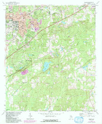
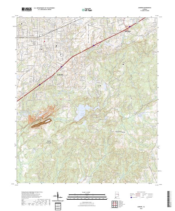
The sprawling campus of Auburn University and the surrounding urban corridors of Auburn and Opelika define this contemporary topographical survey. The map details a sophisticated network of transportation and water management, where Interstate 85 cuts through the landscape between the two cities, passing near Moores Mill Creek and Auburn City Lake. For those tracing local heritage, the density of municipal and family cemeteries is striking, ranging from Pine Hill Cem and Westview Cem in the city center to more outlying sites like Chamlee Cem and Mount Olive Cem.
Find a feature on this map
47 named features on this map. Tap any name to fly to it.
Don’t see what you’re looking for? This feature index may not catch every label — zoom into the map to look around manually.
Map Details
Editions of this 2024 Auburn Map
This is the sole edition of this map. No revisions or reprints were ever made.