2022 Map of Auburn
USGS Topo · Published 2022About this map
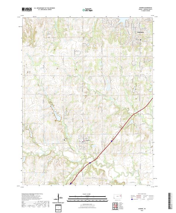
Auburn and its surrounding agricultural plains are defined by the convergence of the Wakarusa River and its major tributaries in Shawnee County. The landscape follows a dendritic drainage pattern where the N Br Wakarusa River and S Br Wakarusa River meet south of the town center. To the northeast, the outskirts of Topeka begin to encroach upon the rural sections, evidenced by the dense grid of residential streets such as SW Shenandoah Rd and SW Stonybrook Dr. Local genealogy is anchored by the Auburn Cem and the Elevation Cem situated near the headwaters of Blacksmith Cr. The map illustrates a transition from the structured township blocks of t12s r14e to the winding creek beds of Sixmile Cr, showing how modern arterial roads like SW Wanamaker Rd now serve a landscape once dictated entirely by the river forks.
Find a feature on this map
70 named features on this map. Tap any name to fly to it.
Don’t see what you’re looking for? This feature index may not catch every label — zoom into the map to look around manually.
Map Details
Editions of this 2022 Auburn Map
This is the sole edition of this map. No revisions or reprints were ever made.