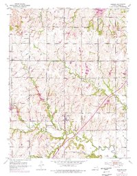
1952 Map of Auburn
USGS Topo · Published 1976About this map
The South Boundary Old Potawatomi Reservation cuts across the northern landscape of Shawnee County, providing a historical anchor for this rural Kansas territory. Centered on the community of Auburn, the map reveals a mid-century agricultural area defined by its water systems and local institutions. The Wakarusa River meanders through the southern sections, fed by tributaries including Blacksmith Creek, Middle Branch, and South Branch.
Find a feature on this map
21 named features on this map. Tap any name to fly to it.
Don’t see what you’re looking for? This feature index may not catch every label — zoom into the map to look around manually.
Map Details
Editions of this 1952 Auburn Map
4 editions found
Other maps of this area

1889 · Burlingame
USGS Topo · 1:125,000

1889 · Topeka
USGS Topo · 1:125,000

1894 · Burlingame
USGS Topo · 1:125,000

1894 · Topeka
USGS Topo · 1:125,000

1947 · Lawrence
USGS Topo · 1:250,000

1950 · Kansas City
USGS Topo · 1:250,000

1950 · Lawrence
USGS Topo · 1:250,000

1950 · Topeka
USGS Topo · 1:24,000

1951 · Topeka
USGS Topo · 1:24,000

1952 · Auburn
USGS Topo · 1:24,000