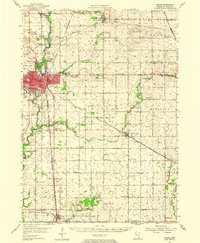
1954 Map of Austin
USGS Topo · Published 1975About this map
Austin serves as the industrial and civic anchor of Mower County in this mid-century survey, revealing a landscape defined by its river valleys and dense rail network. The Cedar River flows through the heart of the city, flanked by Horace Austin State Park and East Side Lake, while the Chicago Milwaukee St Paul and Pacific and other rail lines converge on the urban center. Educational and community institutions are well-documented, from the centrally located Jr College and Sumner Sch to rural landmarks like Hoflanda Ch and Nevada Center Sch.
Find a feature on this map
73 named features on this map. Tap any name to fly to it.
Don’t see what you’re looking for? This feature index may not catch every label — zoom into the map to look around manually.
Map Details
Editions of this 1954 Austin Map
2 editions found
Other maps of this area

1954 · Hayward
USGS Topo · 1:62,500

1954 · Austin
USGS Topo · 1:62,500

1954 · Mason City
USGS Topo · 1:250,000

1955 · High Forest
USGS Topo · 1:62,500

1957 · Mason City
USGS Topo · 1:250,000

1958 · Mason City
USGS Topo · 1:250,000

1965 · Dexter
USGS Topo · 1:24,000

1965 · Adams
USGS Topo · 1:24,000

1966 · Waltham
USGS Topo · 1:24,000

1966 · Sargeant
USGS Topo · 1:24,000