2023 Map of Avalon
USGS Topo · Published 2023About this map
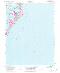
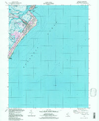
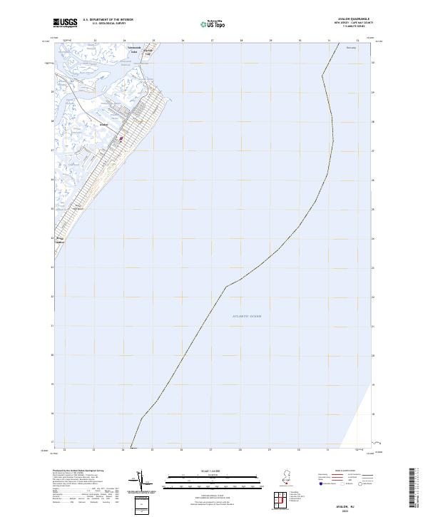
Seven Mile Beach and its surrounding coastal waterways dominate this contemporary survey of the New Jersey shoreline. The grid layout of Avalon is clearly defined, showing the residential density between Dune Dr and the Atlantic Ocean. To the north, Townsends Inlet separates the barrier island from Sea Isle City, while the southern end of the quadrangle reaches into Stone Harbor. The map illustrates a complex network of marshes and tidal channels, including Pennsylvania Harbor and Princeton Harbor, which reflect the extensive coastal development and maritime infrastructure of the region. This modern topographic view details the Intracoastal Waterway and various thorofares like Leonard Thorofare and Ingram Thorofare that serve as vital arteries for local navigation and coastal ecology.
Find a feature on this map
47 named features on this map. Tap any name to fly to it.
Don’t see what you’re looking for? This feature index may not catch every label — zoom into the map to look around manually.
Map Details
Editions of this 2023 Avalon Map
This is the sole edition of this map. No revisions or reprints were ever made.
Historical Maps of Avalon Through Time
3 maps found