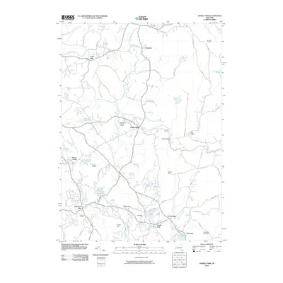
2010 Map of Averill Park
USGS Topo · Published 2010About this map
Eagle Mills and Brunswick sit along the northern reaches of this Rensselaer County landscape, where the waters of the Poesten Kill and Quacken Kill carve through the terrain. The map captures a mix of established hamlet centers and significant local landmarks, including the Rensselaer County Airport near Poestenkill and the Pine Bowl Speedway further south. To the southwest, the village of West Sand Lake is documented near Elmwood Cemetery, while the southeastern corner is defined by the recreation-focused waters of Crystal Lake, Glass Lake, and Sand Lake. This survey illustrates the modern road network, such as White Church Rd and Plank Rd, which connect the scattered settlements. Local history and genealogy are supported by the inclusion of several family-named burial grounds like Morrison Cemetery and Bonesteel Cemetery, as well as distinct topographic features like Crystal Cliff and Snake Hill.
Find a feature on this map
82 named features on this map. Tap any name to fly to it.
Don’t see what you’re looking for? This feature index may not catch every label — zoom into the map to look around manually.
Map Details
Editions of this 2010 Averill Park Map
This is the sole edition of this map. No revisions or reprints were ever made.
Other maps of this area

1888 · Berlin
USGS Topo · 1:62,500

1890 · Berlin
USGS Topo · 1:62,500

1893 · Cohoes
USGS Topo · 1:62,500

1893 · Troy
USGS Topo · 1:62,500

1894 · Berlin
USGS Topo · 1:62,500

1895 · Troy
USGS Topo · 1:62,500

1895 · Cohoes
USGS Topo · 1:62,500

1897 · Hoosick
USGS Topo · 1:62,500

1898 · Berlin
USGS Topo · 1:62,500

1898 · Cohoes
USGS Topo · 1:62,500