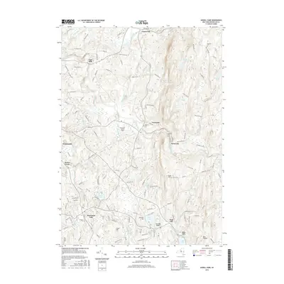
2016 Map of Averill Park
USGS Topo · Published 2016About this map
Poestenkill and Wynantskill anchor this landscape in central Rensselaer County, where the topography rises sharply from the Hudson Valley toward the plateau to the east. The terrain is defined by the carved paths of the Quacken Kill and the Poesten Kill, which cut through the uplands near Barberville and Eagle Mills. This 2016 survey documents the suburban and rural character of the region, featuring significant local aviation at the Rensselaer County Airport and a string of recreational water bodies including Crystal Lake, Glass Lake, and Racquet Lake. Genealogists will find numerous small burial grounds preserved across the townships, such as Hillside Cem and Brookside Cem, while landmarks like Snake Hill and Bare Top Mtn provide fixed points for understanding the area's physical geography. The settlement pattern remains closely tied to the historic road network, with clusters of development at West Sand Lake and Cropseyville reflecting the area's transition from early industrial hamlets to modern residential communities.
Find a feature on this map
127 named features on this map. Tap any name to fly to it.
Don’t see what you’re looking for? This feature index may not catch every label — zoom into the map to look around manually.
Map Details
Editions of this 2016 Averill Park Map
This is the sole edition of this map. No revisions or reprints were ever made.
Other maps of this area

1888 · Berlin
USGS Topo · 1:62,500

1890 · Berlin
USGS Topo · 1:62,500

1893 · Cohoes
USGS Topo · 1:62,500

1893 · Troy
USGS Topo · 1:62,500

1894 · Berlin
USGS Topo · 1:62,500

1895 · Troy
USGS Topo · 1:62,500

1895 · Cohoes
USGS Topo · 1:62,500

1897 · Hoosick
USGS Topo · 1:62,500

1898 · Berlin
USGS Topo · 1:62,500

1898 · Cohoes
USGS Topo · 1:62,500