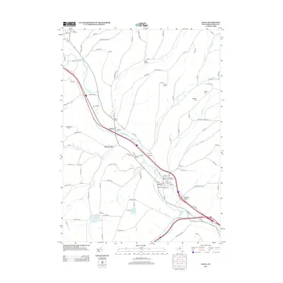
2013 Map of Avoca
USGS Topo · Published 2013About this map
The Cohocton River valley serves as the central artery for this portion of Steuben County, where the village of Avoca and the hamlet of Wallace follow the water's path. This landscape is defined by the convergence of several significant tributaries, including Neils Cr and Salmon Cr, which cut through the surrounding uplands like Waterbury Hill and Wagner Hill. The mapping of these valleys reveals a cluster of early burial grounds that serve as vital records for local genealogy, including the Old Cem of Avoca and the Vale of Rest Cem. Along the riverbanks, smaller settlements like Bloomerville and Lyon Hollow illustrate the historic distribution of population centers tied to the valley floor. Toward the southwestern corner, Smith Pond and Loucks Pond mark a shift into a more lake-dotted terrain, offering a look at the county's diverse geography during the early 21st century.
Find a feature on this map
110 named features on this map. Tap any name to fly to it.
Don’t see what you’re looking for? This feature index may not catch every label — zoom into the map to look around manually.
Map Details
Editions of this 2013 Avoca Map
This is the sole edition of this map. No revisions or reprints were ever made.
Other maps of this area

1900 · Naples
USGS Topo · 1:62,500

1902 · Wayland
USGS Topo · 1:62,500

1903 · Naples
USGS Topo · 1:62,500

1904 · Wayland
USGS Topo · 1:62,500

1910 · Bath
USGS Topo · 1:62,500

1913 · Naples
USGS Topo · 1:62,500

1915 · Hornell
USGS Topo · 1:62,500

1918 · Hornell
USGS Topo · 1:62,500

1942 · Wayland
USGS Topo · 1:31,680

1942 · Naples
USGS Topo · 1:31,680