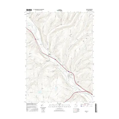
2016 Map of Avoca
USGS Topo · Published 2016About this map
The Cohocton River valley serves as the central corridor for this part of Steuben County, anchoring the primary settlements of Avoca, Wallace, Bloomerville, and a portion of Cohocton. The landscape is defined by its deep, narrow valleys and the numerous hills that separate them, such as Waterbury Hill, Wagner Hill, and Cance Hill. This 2016 survey illustrates the persistent agricultural and rural character of the region, where family-named roads and landmarks remain prominent. Genealogists will find a significant density of burial sites throughout the quadrangle, ranging from the large Cem of Avoca and Highland Cem to smaller, upland locations like Olmstead Hill Cem and Smith Pond Cem. The drainage network, including Tenmile Cr and Salmon Cr, feeds into the Cohocton, while upland water bodies like Smith Pond and Loucks Pond dot the higher elevations between the hollows.
Find a feature on this map
105 named features on this map. Tap any name to fly to it.
Don’t see what you’re looking for? This feature index may not catch every label — zoom into the map to look around manually.
Map Details
Editions of this 2016 Avoca Map
This is the sole edition of this map. No revisions or reprints were ever made.
Other maps of this area

1900 · Naples
USGS Topo · 1:62,500

1902 · Wayland
USGS Topo · 1:62,500

1903 · Naples
USGS Topo · 1:62,500

1904 · Wayland
USGS Topo · 1:62,500

1910 · Bath
USGS Topo · 1:62,500

1913 · Naples
USGS Topo · 1:62,500

1915 · Hornell
USGS Topo · 1:62,500

1918 · Hornell
USGS Topo · 1:62,500

1942 · Wayland
USGS Topo · 1:31,680

1942 · Naples
USGS Topo · 1:31,680