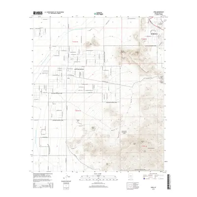
2014 Map of Avra
USGS Topo · Published 2014About this map
Saguaro National Park dominates this desert landscape, preserving a dramatic segment of the Tucson Mountains as they stood in the early 21st century. The map highlights the transition from the modern development of Marana and the residential corridors of Picture Rocks to the high-elevation peaks of the range, including Wasson Peak and Amole Peak. Modern infrastructure is visible through the winding path of the Central Arizona Project Aqueduct, which cuts across the arid basin of the Avra Valley to the west. Local landmarks like King Canyon and Contzen Pass provide specific points of reference for those studying the physical geography of the region. The map also traces the ephemeral drainage of Brawley Wash, illustrating the drainage patterns that define this part of the Sonoran Desert.
Find a feature on this map
108 named features on this map. Tap any name to fly to it.
Don’t see what you’re looking for? This feature index may not catch every label — zoom into the map to look around manually.
Map Details
Editions of this 2014 Avra Map
This is the sole edition of this map. No revisions or reprints were ever made.
Other maps of this area

1925 · San Xavier
USGS Topo · 1:62,500

1934 · Tucson Mountains
USGS Topo · 1:125,000

1941 · Cocoraque Butte
USGS Topo · 1:62,500

1943 · Cocoraque Butte
USGS Topo · 1:62,500

1943 · San Xavier Mission
USGS Topo · 1:62,500

1947 · Cortaro
USGS Topo · 1:62,500

1956 · Tucson
USGS Topo · 1:250,000

1957 · San Xavier Mission
USGS Topo · 1:62,500

1957 · Cortaro
USGS Topo · 1:62,500

1958 · Tucson
USGS Topo · 1:250,000