2024 Map of Axson
USGS Topo · Published 2024About this map
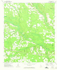
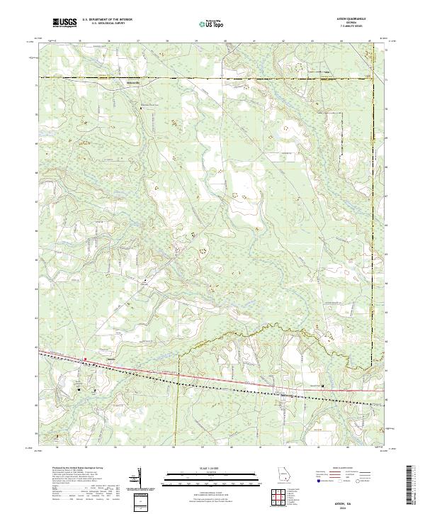
The Satilla River and the Seventeen Mile River define the watery landscape of this South Georgia territory, where the borders of Coffee, Atkinson, and Ware counties converge. The settlement of Axson serves as a central hub, situated along the primary east-west corridor of Atkinson Blvd, while the smaller communities of Stokesville to the north and Millwood to the southeast anchor the outlying rural reaches. This modern survey reveals a landscape deeply connected to its past through numerous burial grounds, including the Axson Community Cem, Stokesville Church Cem, and the uniquely named Little Utah Cem. The drainage patterns of Red Bluff Creek and Smut Branch illustrate the low-lying, creek-fed terrain typical of the wiregrass region, where local life remains oriented around these persistent watercourses and the network of county roads like Stokesville Church Rd that connect the scattered farmsteads and historic church sites.
Find a feature on this map
95 named features on this map. Tap any name to fly to it.
Don’t see what you’re looking for? This feature index may not catch every label — zoom into the map to look around manually.
Map Details
Editions of this 2024 Axson Map
This is the sole edition of this map. No revisions or reprints were ever made.