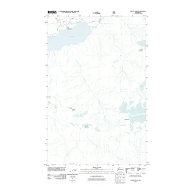
2011 Map of Bacon Peak
USGS Topo · Published 2011About this map
Baker Lake and the Baker River dominate the northern portion of this high-elevation mountain landscape, reflecting the drainage patterns of the North Cascades during the early 21st century. The map centers on the massive form of Bacon Peak, surrounded by a complex network of glacial-fed drainages including Noisy Creek, Diobsud Creek, and Silver Creek. The presence of the Anderson Butte Lookout and the Shannon Creek Campground indicates the area's significance for forest management and backcountry recreation. Notable clusters of high alpine water bodies, such as Watson Lakes, Anderson Lakes, and the isolated Ipsoot Lake, are interspersed among prominent summits like Mount Watson and Hagan Mountain. The road network is sparse, limited primarily to Baker Lake Rd along the western shoreline, illustrating the region's protected and primitive character.
Find a feature on this map
23 named features on this map. Tap any name to fly to it.
Don’t see what you’re looking for? This feature index may not catch every label — zoom into the map to look around manually.
Map Details
Editions of this 2011 Bacon Peak Map
This is the sole edition of this map. No revisions or reprints were ever made.
Other maps of this area

1909 · Mt Baker
USGS Topo · 1:192,000

1915 · Mt. Baker
USGS Topo · 1:250,000

1952 · Lake Shannon
USGS Topo · 1:62,500

1953 · Mt Shuksan
USGS Topo · 1:62,500

1953 · Marblemount
USGS Topo · 1:62,500

1953 · Mt Challenger
USGS Topo · 1:62,500

1955 · Concrete
USGS Topo · 1:250,000

1958 · Concrete
USGS Topo · 1:250,000

1962 · Concrete
USGS Topo · 1:250,000

1979 · Mt. Baker
USGS Topo · 1:100,000