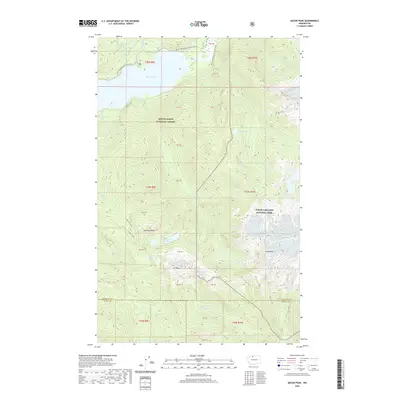
2020 Map of Bacon Peak
USGS Topo · Published 2020About this map
Mount Baker National Forest and North Cascades National Park meet in this high-elevation landscape, where the jagged skyline is dominated by the massive profile of Bacon Peak and Mt Watson. The terrain is defined by extreme relief and glacial hydrology, with drainage systems like Noisy Creek and Diobsud Creek carving deep basins below the summits. High-altitude water bodies including Watson Lakes, Anderson Lakes, and the secluded Ipsoot Lake sit in alpine cirques, while the northern extent of the map shows the upper reach of Baker Lake where the Baker River enters. For those tracing regional paths, the Pacific NW National Scenic Trail winds across the northern ridges, providing a continuous line through the varied forest and rock of the Whatcom and Skagit county line.
Find a feature on this map
25 named features on this map. Tap any name to fly to it.
Don’t see what you’re looking for? This feature index may not catch every label — zoom into the map to look around manually.
Map Details
Editions of this 2020 Bacon Peak Map
This is the sole edition of this map. No revisions or reprints were ever made.
Other maps of this area

1909 · Mt Baker
USGS Topo · 1:192,000

1915 · Mt. Baker
USGS Topo · 1:250,000

1952 · Lake Shannon
USGS Topo · 1:62,500

1953 · Mt Shuksan
USGS Topo · 1:62,500

1953 · Marblemount
USGS Topo · 1:62,500

1953 · Mt Challenger
USGS Topo · 1:62,500

1955 · Concrete
USGS Topo · 1:250,000

1958 · Concrete
USGS Topo · 1:250,000

1962 · Concrete
USGS Topo · 1:250,000

1979 · Mt. Baker
USGS Topo · 1:100,000