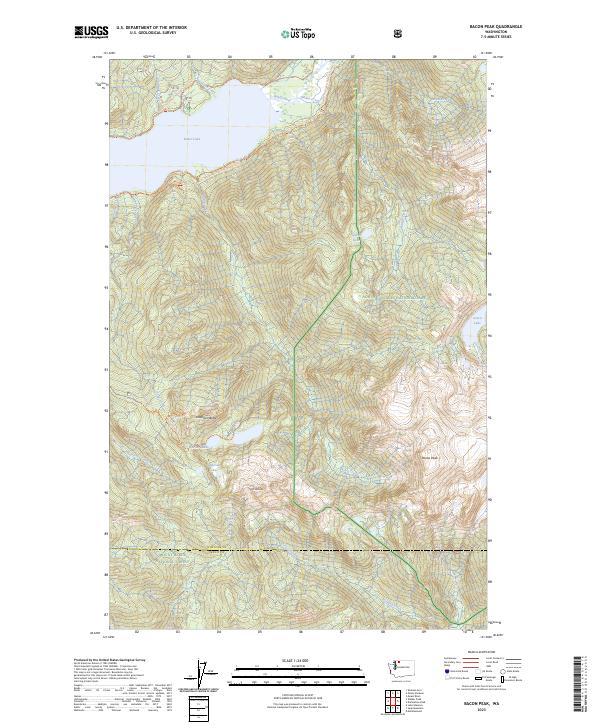
2023 Map of Bacon Peak
USGS Topo · Published 2023About this map
Baker Lake and the Baker River dominate the northwestern reaches of this high-country survey, where glacial drainage systems carve deep through the North Cascades. The landscape is defined by its protected status, partitioned between the North Cascades National Park, the Stephen Mather Wilderness, and the Mount Baker National Forest. High-elevation water bodies like Watson Lakes, Anderson Lakes, and Ipsut Lake sit tucked below prominent summits including Anderson Butte and Mt Watson. This modern topographic study illustrates the established network of backcountry access, centered on the Pacific Northwest National Scenic Trl and the Watson Lakes Trl. The boundary between Whatcom and Skagit counties traverses the southern peaks, marking a divide between the Noisy-Diobsud Wilderness and the northern drainages.
Find a feature on this map
32 named features on this map. Tap any name to fly to it.
Don’t see what you’re looking for? This feature index may not catch every label — zoom into the map to look around manually.
Map Details
Editions of this 2023 Bacon Peak Map
This is the sole edition of this map. No revisions or reprints were ever made.
Other maps of this area

1909 · Mt Baker
USGS Topo · 1:192,000

1915 · Mt. Baker
USGS Topo · 1:250,000

1952 · Lake Shannon
USGS Topo · 1:62,500

1953 · Mt Shuksan
USGS Topo · 1:62,500

1953 · Marblemount
USGS Topo · 1:62,500

1953 · Mt Challenger
USGS Topo · 1:62,500

1955 · Concrete
USGS Topo · 1:250,000

1958 · Concrete
USGS Topo · 1:250,000

1962 · Concrete
USGS Topo · 1:250,000

1979 · Mt. Baker
USGS Topo · 1:100,000