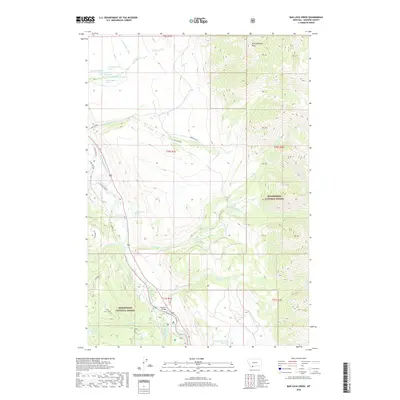
2020 Map of Bad Luck Creek
USGS Topo · Published 2020About this map
Madison River and West Fork Madison River converge in this high-altitude landscape within the Beaverhead National Forest. This modern survey documents a topography defined by steep drainage networks and thermal features, notably the Wolf Creek Hot Spring and several named springs such as 10S01E04CCCC01 Spring. The rugged elevations are anchored by Alex Diekmann Peak and Gold Butte, while the valley floors show modern land use through the Sun West Ranch and road developments like Badluck Way. The map preserves the location of Hutchins Bridge, a critical crossing point for the river system. Hydrological detail is dense, following the paths of Sun Creek, Moose Creek, and Papoose Creek as they feed into the primary river corridors near the Secret Lakes.
Find a feature on this map
43 named features on this map. Tap any name to fly to it.
Don’t see what you’re looking for? This feature index may not catch every label — zoom into the map to look around manually.
Map Details
Editions of this 2020 Bad Luck Creek Map
This is the sole edition of this map. No revisions or reprints were ever made.
Other maps of this area

1888 · Three Forks
USGS Topo · 1:250,000

1894 · Three Forks
USGS Topo · 1:250,000

1895 · Three Forks
USGS Topo · 1:250,000

1947 · Bozeman
USGS Topo · 1:250,000

1948 · Bozeman
USGS Topo · 1:250,000

1950 · Cliff Lake
USGS Topo · 1:62,500

1950 · Hebgen Dam
USGS Topo · 1:62,500

1950 · Cameron
USGS Topo · 1:62,500

1950 · Sphinx Mountain
USGS Topo · 1:62,500

1955 · Bozeman
USGS Topo · 1:250,000