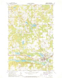
1943 Map of Bagley
USGS Topo · Published 1943About this map
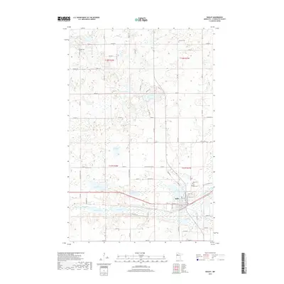
Bagley serves as a focal point for this northern Minnesota landscape, situated along the Great Northern railroad line that facilitates the region's movement of timber and goods. The terrain is defined by a dense network of lakes and waterways, including Lake Lomond, Four Legged Lake 1432, and the winding Pine River. This survey, compiled from data reaching back to early 20th-century drainage studies of ceded Chippewa lands, illustrates a patchwork of timbered areas and small agricultural openings. Settlements such as Clearbrook, Leonard, and Shevlin are linked by established routes like the Saint Marie Road. An Indian Reservation Boundary cuts across the southern portion of the quadrangle, indicating the complex history of land tenure and demarcated space in Clearwater County during this era.
Find a feature on this map
48 named features on this map. Tap any name to fly to it.
Don’t see what you’re looking for? This feature index may not catch every label — zoom into the map to look around manually.
Map Details
Editions of this 1943 Bagley Map
This is the sole edition of this map. No revisions or reprints were ever made.
Historical Maps of Bagley Through Time
7 maps found