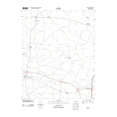
2010 Map of Bailey
USGS Topo · Published 2010About this map
Bloomery Swamp and Toisnot Swamp dominate the low-lying drainage patterns of this Nash and Wilson County landscape at the beginning of the 21st century. The town of Bailey and the village of Sims serve as primary population centers, connected by a network of rural roads that frequently intersect at historic points such as Strickland Crossroads and High Crossroads. The landscape is defined by its transition from agricultural fields to dense wetland thickets, with numerous man-made impoundments like Stanciels Pond, Morgans Pond, and Finchs Millpond providing evidence of local water management and historical milling sites. Genealogists may find interest in the documented location of the Bailey Cemetery and the various crossroads settlements like Floods Chapel and Stanhope that preserved community identities across the coastal plain.
Find a feature on this map
81 named features on this map. Tap any name to fly to it.
Don’t see what you’re looking for? This feature index may not catch every label — zoom into the map to look around manually.
Map Details
Editions of this 2010 Bailey Map
This is the sole edition of this map. No revisions or reprints were ever made.
Other maps of this area

1902 · Kenly
USGS Topo · 1:62,500

1902 · Rocky Mount
USGS Topo · 1:62,500

1902 · Spring Hope
USGS Topo · 1:62,500

1903 · Kenly
USGS Topo · 1:62,500

1904 · Rocky Mount
USGS Topo · 1:62,500

1904 · Springhope
USGS Topo · 1:62,500

1904 · Wilson
USGS Topo · 1:62,500

1953 · Rocky Mount
USGS Topo · 1:250,000

1953 · Raleigh
USGS Topo · 1:250,000

1954 · Rocky Mount
USGS Topo · 1:250,000