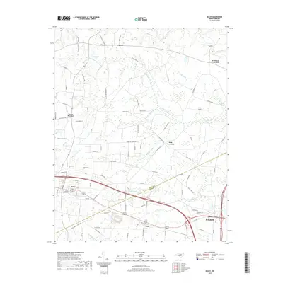
2019 Map of Bailey
USGS Topo · Published 2019About this map
The town of Bailey serves as the focal point of this Eastern North Carolina landscape, where the Nash Co and Wilson Co line divides a terrain defined by extensive wetlands and historic crossroads. The drainage patterns of the coastal plain are clearly visible through the sprawling reaches of Toisnot Swamp, Whiteoak Swamp, and Bloomer Swamp, which feed into larger arteries like the Tar River in the northeast corner. These swamp systems influenced the placement of early infrastructure, leaving a legacy of family-named landmarks and rural hubs such as Stanhope, Strickland Crossroads, and High Crossroads. Small-scale water management is evident at Stanciels Pond and Finchs Millpond, while the southern portion of the map shows the community of Sims and the rural area of Lamm. The network of roads, including Old Smithfield Rd and Old Bailey Hwy, illustrates how transportation evolved around the natural barriers of the swampy bottomlands.
Find a feature on this map
104 named features on this map. Tap any name to fly to it.
Don’t see what you’re looking for? This feature index may not catch every label — zoom into the map to look around manually.
Map Details
Editions of this 2019 Bailey Map
This is the sole edition of this map. No revisions or reprints were ever made.
Other maps of this area

1902 · Kenly
USGS Topo · 1:62,500

1902 · Rocky Mount
USGS Topo · 1:62,500

1902 · Spring Hope
USGS Topo · 1:62,500

1903 · Kenly
USGS Topo · 1:62,500

1904 · Rocky Mount
USGS Topo · 1:62,500

1904 · Springhope
USGS Topo · 1:62,500

1904 · Wilson
USGS Topo · 1:62,500

1953 · Rocky Mount
USGS Topo · 1:250,000

1953 · Raleigh
USGS Topo · 1:250,000

1954 · Rocky Mount
USGS Topo · 1:250,000