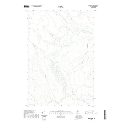
2021 Map of Baker Lake NW
USGS Topo · Published 2021About this map
The Southwest Branch Saint John River and Baker Branch Saint John River converge in this remote timberland region of Somerset County. The landscape is defined by the hydrologic network of the Saint John River's upper reaches, showing a complex system of riparian wetlands and drainage basins. This area of T9 R17 WELS is largely inaccessible except for a skeleton network of logging and service roads, including St Juste Rd and Foss Brooke Rd, which follow the natural contours of the valley. The map provides an essential record of the contemporary drainage patterns and forest infrastructure in the Maine North Woods, where the terrain transitions from steep ridges to broad, marshy river bottoms near Brailey Brook Rd.
Find a feature on this map
6 named features on this map. Tap any name to fly to it.
Don’t see what you’re looking for? This feature index may not catch every label — zoom into the map to look around manually.
Map Details
Editions of this 2021 Baker Lake NW Map
This is the sole edition of this map. No revisions or reprints were ever made.
Other maps of this area

1954 · Baker Lake
USGS Topo · 1:62,500

1954 · Presque Isle
USGS Topo · 1:250,000

1955 · Beaver Pond
USGS Topo · 1:62,500

1957 · Hardwood Mountain
USGS Topo · 1:62,500

1958 · Presque Isle
USGS Topo · 1:250,000

1960 · Presque Isle
USGS Topo · 1:250,000

1962 · Baker Lake
USGS Topo · 1:62,500

1962 · Quebec
USGS Topo · 1:250,000
1986 · Beaver Pond SE
USGS Topo · 1:24,000
1986 · Chamberlain Lake
USGS Topo · 1:100,000