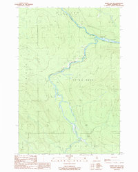
1989 Map of Baker Lake NW
USGS Topo · Published 1989About this map
The Baker Branch St John River and Southwest Branch St John River converge in this remote timberland region of Somerset County, reflecting the deep wilderness character of the Maine woods in the late 1980s. The landscape is defined by its water system and the survey divisions of the public lands, including Big Ten WELS and T 9 R 17 Wels. Resource extraction and recreation provide the few human markers on the land, such as a Gravel Pit and scattered landing spots like the Flaws Bogan Campsite. The presence of named Rapids along the river branches highlights the natural flow of the St. John watershed before any major modern diversions, while features like Flaws Bogan suggest the specific marshy terrain that dictates the local geography.
Find a feature on this map
13 named features on this map. Tap any name to fly to it.
Don’t see what you’re looking for? This feature index may not catch every label — zoom into the map to look around manually.
Map Details
Editions of this 1989 Baker Lake NW Map
This is the sole edition of this map. No revisions or reprints were ever made.
Other maps of this area

1954 · Baker Lake
USGS Topo · 1:62,500

1954 · Presque Isle
USGS Topo · 1:250,000

1955 · Beaver Pond
USGS Topo · 1:62,500

1957 · Hardwood Mountain
USGS Topo · 1:62,500

1958 · Presque Isle
USGS Topo · 1:250,000

1960 · Presque Isle
USGS Topo · 1:250,000

1962 · Baker Lake
USGS Topo · 1:62,500

1962 · Quebec
USGS Topo · 1:250,000
1986 · Beaver Pond SE
USGS Topo · 1:24,000
1986 · Chamberlain Lake
USGS Topo · 1:100,000