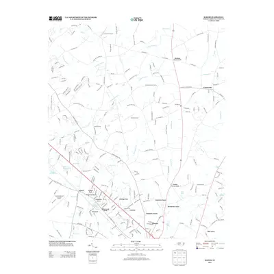
2013 Map of Bakers
USGS Topo · Published 2013About this map
Bentons Crossroads and Unionville anchor this portion of Union County, reflecting a landscape where long-standing rural junctions meet modern residential expansion. The map detail highlights a dense network of suburban developments such as Camelot, Pinedell, and Dogwood Acres, which have transformed the area once defined by agricultural fields and timber stands. Water management is a visible priority, with numerous man-made features like Lake Minehaha, Baucom Lake, and the larger Lake Twitty serving the growing population centers.
Find a feature on this map
237 named features on this map. Tap any name to fly to it.
Don’t see what you’re looking for? This feature index may not catch every label — zoom into the map to look around manually.
Map Details
Editions of this 2013 Bakers Map
This is the sole edition of this map. No revisions or reprints were ever made.
Other maps of this area

1941 · Charlotte
USGS Topo · 1:125,000

1941 · Spartanburg
USGS Topo · 1:250,000

1942 · Charlotte
USGS Topo · 1:125,000

1949 · Wilgrove
USGS Topo · 1:24,000

1949 · Midland
USGS Topo · 1:24,000

1953 · Spartanburg
USGS Topo · 1:250,000

1953 · Charlotte
USGS Topo · 1:250,000

1954 · Charlotte
USGS Topo · 1:250,000

1960 · Charlotte
USGS Topo · 1:250,000

1960 · Spartanburg
USGS Topo · 1:250,000