
1949 Map of Midland
USGS Topo · Published 1949About this map
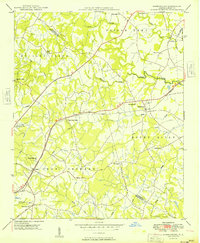
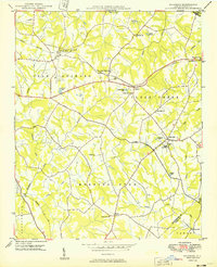
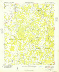
The Norfolk Southern railroad cuts across the northern landscape of this North Carolina quadrangle, anchoring the settlement at Midland where the Mill Grove Ch and the Midland Speedway once drew local residents. The map captures a rural social geography defined by its denominational centers, from Macedonia Ch in the northeast to Arlington Ch and Rock Hill Ch in the southwest.
Find a feature on this map
37 named features on this map. Tap any name to fly to it.
Don’t see what you’re looking for? This feature index may not catch every label — zoom into the map to look around manually.
Map Details
Editions of this 1949 Midland Map
This is the sole edition of this map. No revisions or reprints were ever made.
Other maps of this area

1941 · Charlotte
USGS Topo · 1:125,000

1942 · Charlotte
USGS Topo · 1:125,000
1949 · Harrisburg
USGS Topo · 1:24,000
1949 · Wilgrove
USGS Topo · 1:24,000
1949 · Concord SE
USGS Topo · 1:24,000

1953 · Charlotte
USGS Topo · 1:250,000

1954 · Charlotte
USGS Topo · 1:250,000

1957 · Mount Pleasant
USGS Topo · 1:62,500

1960 · Charlotte
USGS Topo · 1:250,000

1962 · Charlotte
USGS Topo · 1:250,000