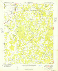
1949 Map of Concord SE
USGS Topo · Published 1949About this map
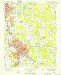
Rocky River winds through this rural Cabarrus County landscape, serving as the central drainage for a network of creeks including Coddle Creek, Reedy Creek, and Coldwater Creek. The 1948 field survey reveals an agrarian economy structured around small rural crossroads and community nodes like Faggarts Crossroads and Flowes Store. Local industry and processing are evidenced by Pharrs Mill and Pioneer Mills, while the Southern railroad line provides the primary connection to the larger regional markets.
Find a feature on this map
38 named features on this map. Tap any name to fly to it.
Don’t see what you’re looking for? This feature index may not catch every label — zoom into the map to look around manually.
Map Details
Editions of this 1949 Concord SE Map
This is the sole edition of this map. No revisions or reprints were ever made.
Other maps of this area

1941 · Charlotte
USGS Topo · 1:125,000

1942 · Charlotte
USGS Topo · 1:125,000
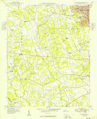
1949 · Kannapolis
USGS Topo · 1:24,000
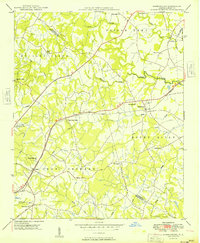
1949 · Harrisburg
USGS Topo · 1:24,000
1949 · Wilgrove
USGS Topo · 1:24,000

1949 · Midland
USGS Topo · 1:24,000
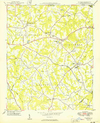
1950 · Concord
USGS Topo · 1:24,000

1953 · Charlotte
USGS Topo · 1:250,000

1954 · Charlotte
USGS Topo · 1:250,000

1957 · Mount Pleasant
USGS Topo · 1:62,500