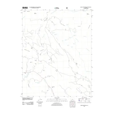
2011 Map of Baldy Mountain
USGS Topo · Published 2011About this map
Baldy Mountain and the surrounding high country of Colorado define this landscape in the early 21st century. The map reveals a history of resource extraction, with several named mining operations including the Medicine Mine in the northeast and the Shamrock Mines near the Shamrock Ranch. The southern portion of the sheet is characterized by the crossing of the Yellowjacket Pass, where the terrain transitions between the steep drainages of Jungle Canyon and Lange Canyon. Local water management is evident through features like Hayden Reservoir Number 1 and Dry Lake Reservoir. The map also captures several springs and creeks that feed into the First Fork Piedra River, illustrating the complex hydrology of this mountainous region. Settlement is sparse, represented by isolated landmarks like the Cooper Mine and Klondike Park, which contrast with the broad reaches of Beaver Meadows and Arbogas Flats.
Find a feature on this map
52 named features on this map. Tap any name to fly to it.
Don’t see what you’re looking for? This feature index may not catch every label — zoom into the map to look around manually.
Map Details
Editions of this 2011 Baldy Mountain Map
This is the sole edition of this map. No revisions or reprints were ever made.
Other maps of this area

1908 · Ignacio
USGS Topo · 1:125,000

1924 · Ignacio
USGS Topo · 1:125,000

1924 · Pagosa Springs
USGS Topo · 1:125,000

1927 · Pagosa Springs
USGS Topo · 1:125,000

1945 · Durango
USGS Topo · 1:250,000

1953 · Durango
USGS Topo · 1:250,000

1954 · Durango
USGS Topo · 1:250,000

1961 · Durango
USGS Topo · 1:250,000

1963 · Durango
USGS Topo · 1:250,000
1964 · Devil Mountain
USGS Topo · 1:24,000