
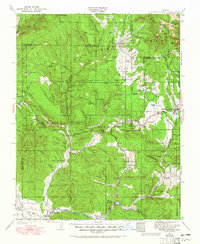
1924 Map of Pagosa Springs
USGS Topo · Published 1958About this map
Pagosa Springs serves as the hub for this high-altitude region where the Pagosa River and Piedra River flow south toward the New Mexico border. Surveyed in the early 1920s, the map reveals a landscape defined by the Denver and Rio Grande Western railroad, which follows the winding course of the San Juan River through Pagosa Junction and Arboles. The presence of numerous remote educational outposts, such as the Stollsteimer School and Bayles School, indicates a dispersed ranching and timber population settled within the San Juan National Forest.
Find a feature on this map
104 named features on this map. Tap any name to fly to it.
Don’t see what you’re looking for? This feature index may not catch every label — zoom into the map to look around manually.
Map Details
Editions of this 1924 Pagosa Springs Map
2 editions found
Other maps of this area

1889 · Largo
USGS Topo · 1:250,000

1895 · Largo
USGS Topo · 1:250,000

1900 · Needle Mountains
USGS Topo · 1:62,500

1902 · Needle Mountains
USGS Topo · 1:62,500

1905 · San Cristobal
USGS Topo · 1:125,000

1907 · San Cristobal
USGS Topo · 1:125,000

1908 · Ignacio
USGS Topo · 1:125,000

1913 · Summitville
USGS Topo · 1:125,000

1914 · Creede
USGS Topo · 1:125,000

1915 · Summitville
USGS Topo · 1:125,000