
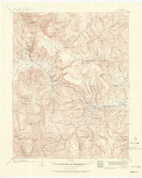
1913 Map of Summitville
USGS Topo · Published 1962About this map
The high-altitude mining district of Summitville and the Alamosa River canyon anchor this 1913 survey, detailing a landscape defined by the Continental Divide and the headwaters of the San Juan River. The mining activity of the era is concentrated in the northeast, where labels like the Asiatic Mine, Pass Me By Mine, and Mammoth Mine sit high above the settlement of Stunner. These industrial footprints contrast with the ranching and timber focus further south and west along the river bottoms.
Find a feature on this map
95 named features on this map. Tap any name to fly to it.
Don’t see what you’re looking for? This feature index may not catch every label — zoom into the map to look around manually.
Map Details
Editions of this 1913 Summitville Map
This is the sole edition of this map. No revisions or reprints were ever made.
Other maps of this area

1889 · Largo
USGS Topo · 1:250,000

1895 · Largo
USGS Topo · 1:250,000

1905 · San Cristobal
USGS Topo · 1:125,000

1907 · San Cristobal
USGS Topo · 1:125,000
1914 · Creede
USGS Topo · 1:125,000

1915 · Summitville
USGS Topo · 1:125,000
1915 · Del Norte
USGS Topo · 1:125,000
1916 · Creede
USGS Topo · 1:125,000
1917 · Del Norte
USGS Topo · 1:125,000

1918 · Tusas
USGS Topo · 1:125,000