
1915 Map of Summitville
USGS Topo · Published 1915About this map
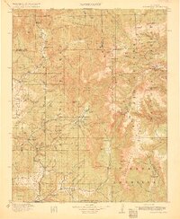
Mining activity and high-altitude ranching define this portion of the San Juan Mountains, where the Continental Divide separates the San Juan National Forest from the Rio Grande National Forest. The northeastern corner is heavily marked by industrial extraction at Summitville and the nearby Platero, featuring specific claims like the Asiatic Mine and Forest King Mine. These mining hubs were supported by high-mountain water sources such as the Alamosa River and Wightman Fork. To the south, the landscape shifts toward the Chama River headwaters, documenting early 20th-century education at the Blanco Basin School and Blanco School. The presence of the Logging RR near the New Mexico state line and the Chama Club indicates the importance of timber and seasonal recreation alongside established agricultural holdings like Petersons Ranch.
Find a feature on this map
110 named features on this map. Tap any name to fly to it.
Don’t see what you’re looking for? This feature index may not catch every label — zoom into the map to look around manually.
Map Details
Editions of this 1915 Summitville Map
4 editions found
Other maps of this area

1889 · Largo
USGS Topo · 1:250,000

1895 · Largo
USGS Topo · 1:250,000

1905 · San Cristobal
USGS Topo · 1:125,000

1907 · San Cristobal
USGS Topo · 1:125,000

1913 · Summitville
USGS Topo · 1:125,000

1914 · Creede
USGS Topo · 1:125,000

1915 · Del Norte
USGS Topo · 1:125,000

1916 · Creede
USGS Topo · 1:125,000

1917 · Del Norte
USGS Topo · 1:125,000

1918 · Tusas
USGS Topo · 1:125,000