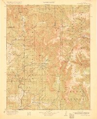
1915 Map of Summitville
USGS Topo · Published 1915About this map
Summitville serves as the focal point for this high-altitude survey, illustrating the intensive gold and silver mining activity concentrated near the Continental Divide. The landscape is dotted with significant industrial operations like the Asiatic Mine, Pass-Me-By Mine, and the Forest King Mine, which speak to the region's mineral-driven economy during the early 20th century. Beyond the major mines, the map details the infrastructure required for such remote work, including the tiny settlements of Stunner and Platoro, along with family-named outposts like the Chapson Ranch and Dowels Ranch.
Find a feature on this map
116 named features on this map. Tap any name to fly to it.
Don’t see what you’re looking for? This feature index may not catch every label — zoom into the map to look around manually.
Map Details
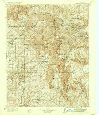
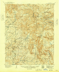
Editions of this 1915 Summitville Map
4 editions found
Other maps of this area

1889 · Largo
USGS Topo · 1:250,000

1895 · Largo
USGS Topo · 1:250,000

1905 · San Cristobal
USGS Topo · 1:125,000

1907 · San Cristobal
USGS Topo · 1:125,000

1913 · Summitville
USGS Topo · 1:125,000

1914 · Creede
USGS Topo · 1:125,000

1915 · Summitville
USGS Topo · 1:125,000

1915 · Del Norte
USGS Topo · 1:125,000

1916 · Creede
USGS Topo · 1:125,000

1917 · Del Norte
USGS Topo · 1:125,000